The K-index describes magnetic disturbance measured at a magnetometer over a three-hour interval. Kp describes planetary magnetic activity using standardized readings from 13 observatories. Neither measures the strength of an HF signal. A higher Kp can warn that ionospheric propagation may become less dependable, especially on susceptible higher-latitude routes, but it cannot tell you whether a particular contact will succeed.
The useful question is therefore not “What Kp number opens or closes this band?” It is “What kind of activity does this reading indicate, when was it measured, and does what I hear on my intended route fit that picture?” The answer starts with identifying the index and the product displaying it.
What a Local K Reading Measures—and What Makes Kp Planetary
NOAA’s Planetary K-index documentation defines a local K reading from the largest fluctuations in the horizontal components of Earth’s magnetic field observed by a magnetometer during a three-hour interval. Local K is an integer from 0 to 9. It describes magnetic disturbance at the observing location—not signal strength at a receiver and not conditions measured along an entire radio path.
The p in Kp means planetary. NOAA describes Kp as a three-hour index formed from the mean of standardized K indices at 13 geomagnetic observatories; GFZ likewise calls it a global magnetic-activity index. Kp is thus not a local station’s integer K copied onto a worldwide map. Standardizing and combining station readings produces a different quantity, even though both quantities concern magnetic disturbance.
The notation can be surprising if you expect every K-related display to show only whole numbers. GFZ’s format documentation describes standardized station values called Ks in thirds of a unit. For example, 3− means 2⅔, 3o means exactly 3, and 3+ means 3⅓. GFZ gives the corresponding encoded file values as 27, 30 and 33. Those file values do not mean Kp 27, Kp 30 or Kp 33; they are a format for the standardized values used in calculating Kp. Nor are the plus and minus signs a separate signal-strength rating.
The name of the product matters as much as its notation. GFZ distributes the internationally recognized official Kp index endorsed by the International Association of Geomagnetism and Aeronomy. It supplies near-real-time nowcasts and, later, monthly definitive values. NOAA also displays an Estimated 3-hour Planetary Kp-index, calculated at its Space Weather Prediction Center from a listed set of ground magnetometers. NOAA says that chart updates every minute. That is a refresh rate for an estimate of a three-hour index—not a new one-minute Kp interval.
Consequently, a NOAA estimate, a GFZ nowcast and a GFZ definitive value should be identified by name when compared. Different estimating inputs, update times and product stages mean a small difference between displayed figures need not represent a contradiction about the same final measurement. A bare “Kp is X” also hides whether X is an estimate, a nowcast or a definitive value. For HF purposes, first identify what was measured, over which interval, and by which product; only then ask what the activity might mean for your path.
Why Geomagnetic Disturbance Can Change an HF Path
Some radio signals reach their destinations by reflecting from, or passing through, the ionosphere. NOAA includes users of those signals among people affected by geomagnetic storms. ARRL describes the broad operating consequence: a geomagnetic storm can add noise and weaken or disrupt ionospheric propagation. That connects a magnetic-activity indicator to a genuine HF concern, but it does not turn the indicator into a receiver reading.
A route is more specific than a planetary index. Two operators looking at the same Kp value may be attempting paths through different regions. One path might pass through high latitudes; another might be much less polar. Kp gives both operators global disturbance context, not a measurement of either path’s received signal. This distinction explains why “elevated Kp” is a reason to pay attention rather than a complete account of what either operator will hear.
ARRL offers a useful conditional example: during a geomagnetic storm, transpolar signals at 14 MHz or higher may be particularly weak, sometimes with a hollow or fluttering sound. “May” and “transpolar” do important work here. ARRL is describing a possible effect on a particular kind of path, not declaring that 14 MHz is a universal cutoff or that every signal above it will fail. The example also describes something an operator might actually notice—a changed sound as well as a weaker signal—without assigning a fixed amount of loss.
It helps to keep three questions separate. Is magnetic activity elevated? Kp can address that planetary question. Is my intended route exposed to the sort of disturbance being described? Its geography, including any higher-latitude or transpolar portion, makes that question more specific. What is happening to signals now? Reception on the intended route supplies evidence that the index itself cannot. ARRL’s transpolar example gives a reason to be particularly cautious about that route; it is not a prediction for a less polar path at the same time.
Fading, intermittency and an unusual signal sound are therefore possible observations to investigate, not effects that can be read off a Kp digit. A disturbed interval might make one attempted route troublesome without establishing the state of every other band or route. Equally, hearing a usable signal does not erase the magnetic reading: it shows that this particular reception is possible under the conditions being experienced. The practical value of Kp is to sharpen attention to vulnerable paths while leaving the verdict on reception to direct observation.
Reading Noaa’s G-scale Landmarks
NOAA’s G scale describes geomagnetic-storm severity. Its levels provide landmarks for interpreting Kp, but they are not HF signal-strength grades. The mapping is worth reading precisely, especially at the top end where thirds notation matters.
| NOAA level | Kp landmark | NOAA’s relevant HF description |
|---|---|---|
| G1 — Minor | 5 | A severity landmark; NOAA’s G1 entry does not state an HF-closure threshold. |
| G2 — Moderate | 6 | HF propagation can fade at higher latitudes. |
| G3 — Strong | 7 | HF radio may be intermittent. |
| G4 — Severe | 8, including 9− | HF propagation may be sporadic. |
| G5 — Extreme | 9o | HF propagation may be impossible in many areas for one to two days. |
The distinction between 9− at G4 and 9o at G5 prevents a common shorthand error: “9” without its sign can obscure which landmark is meant. NOAA’s G4 entry explicitly includes 9−, while its G5 entry gives Kp 9. In GFZ’s thirds notation, 9− and 9o are not identical values.
Read down the HF column as descriptions of possible severity, not as a schedule for your receiver. NOAA names higher latitudes specifically for G2 fading. Its G3 and G4 language becomes more serious—intermittent radio and sporadic propagation—but does not specify that every HF route must behave that way. Even the G5 wording says may be impossible in many areas. The “one to two days” belongs to NOAA’s description of a possible broad G5 impact; it is not a promised outage or recovery time for an individual contact.
For a compact comparison, suppose two intended paths share the same G2 report. The higher-latitude path deserves closer scrutiny because NOAA specifically mentions fading there. The report alone does not establish whether either path is fading at that moment. At G4, concern about unreliable propagation rises, but the label still supplies no number of signal-strength units lost, no band-by-band closure list and no verdict on the less polar path. Those conclusions require evidence about the route, not another interpretation of the G label.
This is why G1 should not be treated as the point at which HF “closes,” or a lower G number as proof that an attempted contact will work. The scale communicates the severity of a geomagnetic event. It gives an operator a reason to look more carefully at propagation, particularly where NOAA or ARRL identifies a susceptible geography, while stopping short of forecasting a particular received signal.
What Kp Cannot Tell You About an HF Failure
NOAA uses separate space-weather scales for three event types: G for geomagnetic storms, R for radio blackouts associated with solar flares, and S for solar-radiation storms. An elevated Kp informs the geomagnetic side of that picture. It does not, by itself, diagnose an R or S event. Conversely, an HF problem that does not appear to fit the G context should not automatically be dismissed as unrelated to space weather.
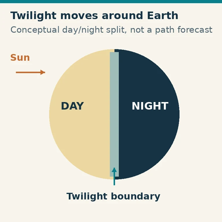
The footprints differ. NOAA places a flare-related radio blackout on Earth’s dayside, with the effect most intense where the Sun is directly overhead. For a solar-radiation storm, NOAA describes energetic protons guided toward the atmosphere near the poles; they can enhance the D layer and block HF communication at high latitudes. These descriptions give different questions to ask about a failing route: is it on the relevant dayside, or does it cross high latitudes? Neither footprint should be assigned wholesale to every geomagnetic G event.
There is also a geographic limit within magnetic measurements. A local K value comes from a magnetometer, whereas planetary Kp combines standardized observations into a global index. Neither is a direct measurement at every point on an HF path. ARRL’s older account illustrates the local limitation by warning that a Boulder K measurement might not correlate well with conditions elsewhere. That is a historical, place-specific illustration of geographic mismatch—not a definition of the current NOAA WWV alert product.
Imagine reception fails on an intended route while the G indicator offers little apparent explanation. That mismatch does not establish the cause. It does make the separate R and S reports, the route’s dayside status and any high-latitude exposure more informative than repeatedly checking Kp alone. Likewise, a high Kp alongside poor reception is consistent with geomagnetic trouble but does not prove that the magnetic disturbance caused this particular failure. Distinct event types and route-specific evidence keep a useful warning from becoming an unsupported diagnosis.
Using the Readings for an Actual Operating Decision
Start with the intended route and UTC period, not a favorite index number. A reading is most useful when its three-hour interval overlaps the time you care about. Next, read the display label: is it a local integer K, NOAA’s estimated planetary Kp, an observed three-hour planetary K value, a GFZ nowcast or definitive Kp value, or a forecast? A forecast is context for a possible later period, not an observation that the disturbance has already occurred.
NOAA’s Planetary K-index material points to Observed Planetary K Index (3 hour intervals) as a recent-reading source. Its geophysical-alert WWV text supplies current long-distance HF context, recent indices, a summary of significant activity and a forecast for the next 24 hours. The current NOAA description explicitly lists both K and A as NOAA-planetary-average indices. It would be incorrect to replace that current product description with ARRL’s older Boulder-local K example.
Compare relevant three-hour readings to see whether the displayed activity is rising, falling or relatively steady across the intervals shown. Then check NOAA’s G, R and S context separately. Match those reports to the geography of the proposed path rather than assuming that one planetary number explains every interruption. Finally, compare with signals or reports actually relevant to that route. A missing chart value, a stale display or readings that do not overlap the intended period provide no measured evidence of quiet conditions for that period.
Here is an invented illustration, not a report of current weather or an actual contact. An operator is considering a high-latitude path on 14 MHz or higher during 18:00–21:00 UTC. The operator labels two hypothetical NOAA estimated three-hour Kp readings: 5 for the preceding interval and 6 for the intended interval. That is a rising displayed trend, with 6 at NOAA’s G2 landmark. The operator also checks the separate R and S context. NOAA’s G2 description makes fading on the higher-latitude route a reasonable concern; ARRL’s transpolar example gives an additional reason to listen for weak or fluttering signals if the route is transpolar. Neither source says that the chosen band has closed.
Suppose, still within this illustration, that reception reports from the intended high-latitude route describe signals fading during the chosen period. Reports for a less polar path during that same period instead describe usable reception. Those hypothetical observations support a limited decision: keep testing the less polar route if that is useful, while treating the high-latitude attempt as uncertain and considering another band or operating time. They do not prove why each signal behaved as it did or promise that a later attempt will succeed. If reception on the high-latitude route were usable instead, that direct observation would matter more to the immediate operating decision than a rule claiming G2 must prevent it.
The same discipline applies when displays disagree. Label a NOAA estimate and a GFZ nowcast separately; do not blend them into a single unexplained “current Kp,” and do not treat a future forecast as a completed observation. Magnetic indices flag a possibility of propagation trouble, the G/R/S reports help distinguish which kind of disturbance may be relevant, and contemporaneous observations on the intended route establish what the operator can actually hear.